THE UNITED REPUBLIC OF TANZANIA NATIONAL EXAMINATIONS COUNCIL OF TANZANIA CERTIFICATE OF SECONDARY EDUCATION EXAMINATION
013 GEOGRAPHY
(For Both School and Private Candidates)
Time: 3:00 Hours Year: 2023
Instructions
This paper consists of sections A, B and C with a total of eleven (11) questions.
Answer all questions in sections A and B and two (2) questions from section C.
Section A carries sixteen (16) marks, section B fifty four (54) marks and section C carries thirty (30) marks.
All writing must be in blue or black ink except drawing which must be in pencil.
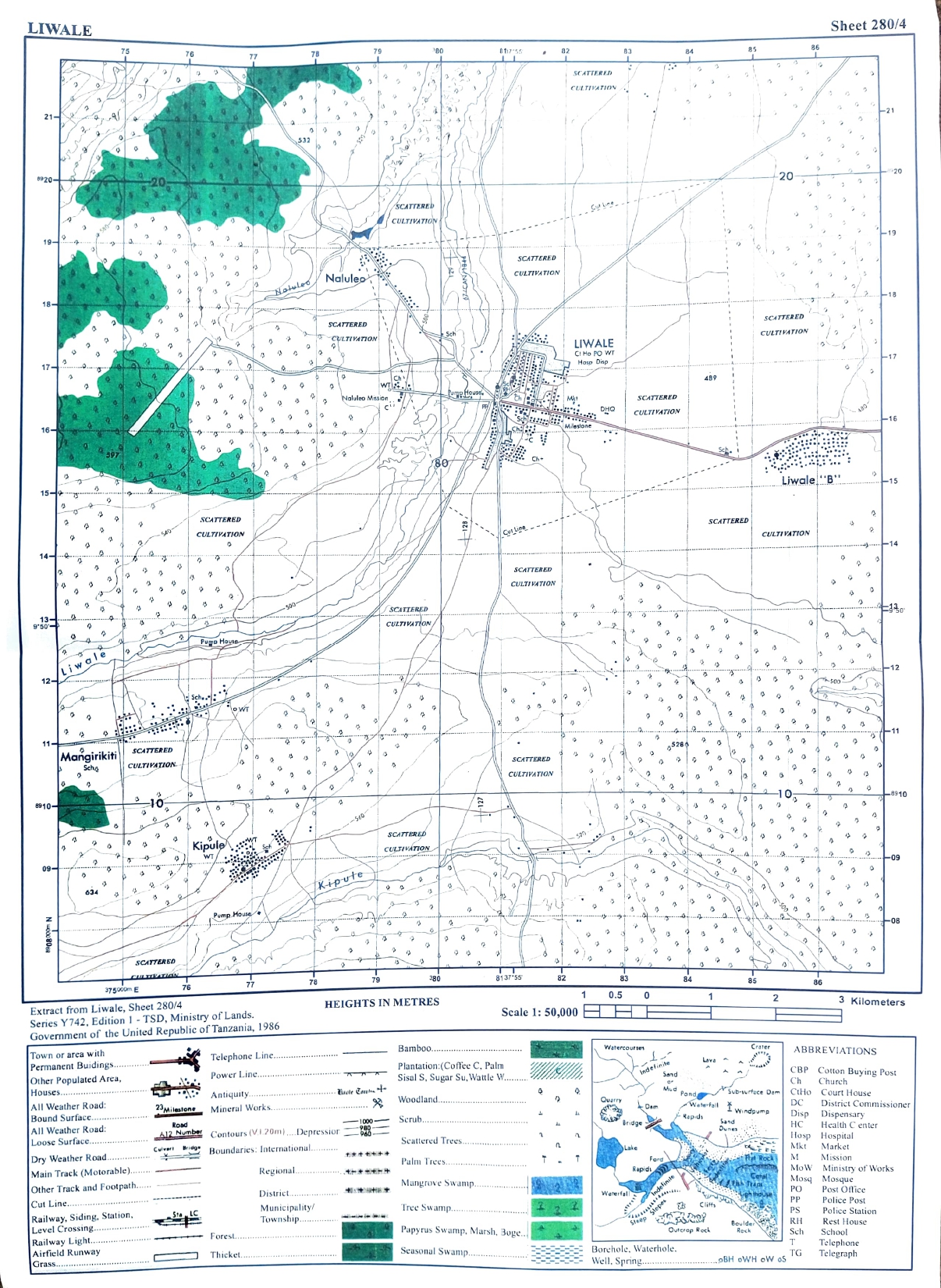
Map extract of Liwale (Sheet 280/4) is provided.
Programmable calculators, communication devices and any unauthorised materials are not allowed in the examination room.
Write your Examination Number on every page of your answer booklet(s).
SECTION A (16 Marks)
Answer all questions in this section.
l. For each of the items (i) - (x), choose the correct answer from the given alternatives and write its letter beside the item number in the answer booklet(s) provided.
(i) What will happen when the orbit of heavenly body is nearest to the Sun?
Perihelion
Aphelion
Sunrise
Equinox
Sunset
Choose Answer :
(ii) At the road construction site, John saw a layer of land with finest soil particles and more humus. Identify the layer observed by him.
B horizon
E horizon
D horizon
A horizon
C horizon
Choose Answer :
(iii) Keino want to transport his car from Japan to Tanzania. Which mode of transport would be best to use?
Water
Pipeline
Cable
Animal
Road
Choose Answer :
(iv) Songoro prefer to cultivate vegetables, maize and beans in his farm. What type of faming is he practicing?
Mixed farming
Bush fallowing
Large scale farming
Crop rotation
Shifting cultivation
Choose Answer :
(v) Sometimes people living in the Central part of Tanzania experience sudden vibrations of the Earth's surface caused by movement of the molten rocks below or within the crust. Identify the instrument to be used to measure the magnitude of such vibrations.
Hygrometer
Thermometer
Wind vane
Richer Scale
Barometer
Choose Answer :
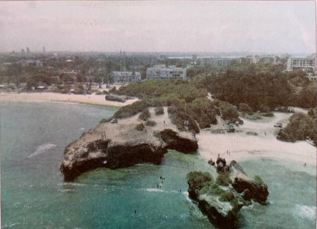
(vi) Coastal areas do not maintain its shape due to erosional and depositional processes.
Which factors influence those processes?
(i) The strength of the wind that blows over the sea
(ii) Weather condition in the area
(iii) The depth of the sea water along the coast
(iv) The nature of the rocks on the coast
(i), (ii) and (iv)
(i), (ii), (iii)
(i), (iii) and (iv)
(ii), (iii) and (iv)
(ii) and (iv)
Choose Answer :
(vii) It is noon in Adis Ababa (390E). What will be the time in Dar es Salaam which is located along the same longitude?
12:00 pm
12:00 am
06:00 pm
11:00 am
06:00 am
Choose Answer :
(viii) Which factors cause Tanzania's population structure to be dynamic?
Fertility, mortality and migration
Fertility, fecundity and migration
Mortality, fertility and fecundity
Migration, mortality and fecundity
Mortality, emigration and fecundity
Choose Answer :
(ix) What could be the appropriate method for extracting gold deposits which are near to the surface?
Shaft mining
Underground mining
Open cast mining
Alluvial mining
Placer mining
Choose Answer :
(x) Why are Japanese ship building industries located along the coast?
Government policy
Presence of skilled labour
Availability of capital
Good supply of power
Presence of natural harbours
Choose Answer :
2. Match the description of environmental issues in List A with their environmental concepts in List B by writing a letter of the corresponding response beside the item number in the answer booklet(s) provided.
List A
List B
A state in which an area experiences prolonged dry period.
Addition of unwanted substances into the environment.
Deterioration of the quality of the land through loss of soil fertility.
Gradual changes of rainfall and temperature in a place.
Processes that lead to the perish of plant and animal species in an area.
Process through which fertile land become dry, waterless and without vegetation.
(b) Mention the first and the last steps that you will use to accomplish the activity. (c) Briefly explain three survey equipments you will use in the field.
8.(a) How do vegetation adapt to the environment in the desert areas? Give five points. (b) Explain four characteristics of vegetation found in desert areas.
9. Juma was travelling from Iringa to Dar es Salaam. On his way, he experienced gradual increase in temperature. In six points, analyse the causes of such a situation.

 For Call,Sms&WhatsApp: 255769929722 / 255754805256
 MATOKEO KIDATO CHA IV 2023
FORM ONE SELECTION 2024
Matokeo Darasa VII 2023
MATOKEO KIDATO CHA IV 2023
FORM ONE SELECTION 2024
Matokeo Darasa VII 2023